an industrial safety & marine products distribution company
an industrial safety & marine products distribution company


This product has been Discontinued
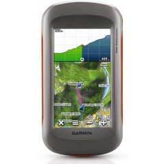
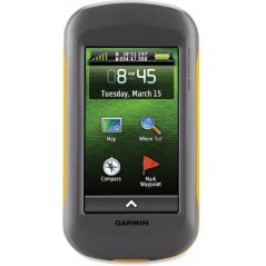
Let the GPS capabilities of the Garmin Oregon 650 lead the way on your next outdoor adventure. This handheld navigation device will indicate your current position and lay digital breadcrumbs showing where you've been.
 Secured
 Fast Delivery
 7 days Return
Key Features
Utilizes GPS and GLONASS Satellites
WAAS-Enabled Receiver
HotFix Satellite Prediction
8 Megapixel Camera with Autofocus & Zoom
3-Axis Compass
Barometric Altimeter
Wireless Data Sharing Capability
Paperless Geocaching Software
4000 Waypoint Memory
Rechargeable Internal NiMH Battery Pack
Garmin 010-01066-20 Overview
Specific References
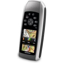
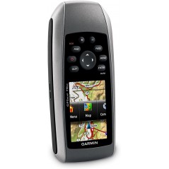
 Garmin GPSMAP 78s Features in Details And More To Know.
GPS Navigation Systems: Guiding Safety, Efficiency, and Precision
Garmin GPSMAP 78s Features in Details And More To Know.
GPS Navigation Systems: Guiding Safety, Efficiency, and Precision
This product has been Discontinued
Let the GPS capabilities of the Garmin Oregon 650 lead the way on your next outdoor adventure. This handheld navigation device will indicate your current position and lay digital breadcrumbs showing where you've been.